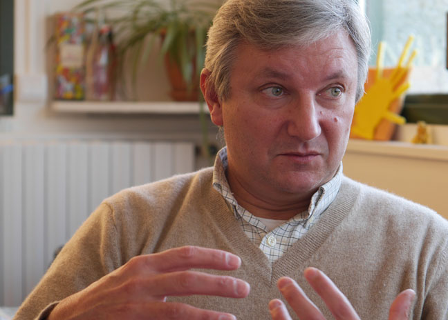
50 Years of Plate Tectonics: Then, Now, and Beyond Interview with Eric Calais
To celebrate the 50th anniversary of the theory of plate tectonics, the Geosciences department at ENS, with support from Collège de France, CNRS-INSU and Total, is hosting an international symposium on June 25-26. The scientists behind the theory will attend. Éric Calais, geologist and ENS professor, discusses the importance of plate tectonics today.
PSL: The theory of plate tectonics has just turned 50--that’s very young for a theory that appears so widely accepted. Can you give us a quick overview of how it came about, including its interactions with various disciplines (such as geology and oceanography)?
Eric Calais: Yes, it’s young; but you have to see this theory as a phoenix rising from its ashes. The story begins in 1912, when Alfred Wegener presented the theory of continental drift, but he lacked sufficient evidence to convince his contemporaries. In the 1950s, scientific advances in the immediate post-war period combined with the geopolitical and military context to allow geologists, oceanographers, seismologists, and other researchers to collect new data. These data tipped the scales.
For example, I could mention the impact of new military seafloor maps, originally produced to optimize underwater warfare, but ultimately providing oceanographers with accurate maps that revealed an extremely organized underwater landscape, including undersea mountain ranges (or ridges) and oceanic trenches. Another example is the development of nuclear testing during the Cold War, which led to the refinement and installation of seismographs, much to the benefit of seismologists’ work. Another collateral effect, if you will: the Cold War encouraged the launch of artificial satellites which, indirectly, enabled the first direct measurement of the movement of plate tectonics from space.
Together, all these observations and data led the scientific community to envision the first 100 km of the Earth as rigid plates that form along the ridges and disappear at the oceanic trenches. One final piece of the puzzle was still missing, however, and that is where the publications now considered foundational entered the scene, in 1967-68. Three researchers developed a mathematical model to calculate the movements of the plates, which they were now able to compare using available data. The initial calculations and publications in 1967 (by Jason Morgan, then Dan McKenzie and Robert Parker) demonstrated the viability of the theory on just a few plates. In 1968, Xavier Le Pichon expanded the calculations to the entire Earth and published an internationally recognized article that definitively confirmed the theory.
You have to understand that this was a real paradigm shift: up to then, the surface of the Earth was viewed solely in terms of vertical movements. Plate tectonics added horizontal movements to the picture, and suddenly everything made more sense.
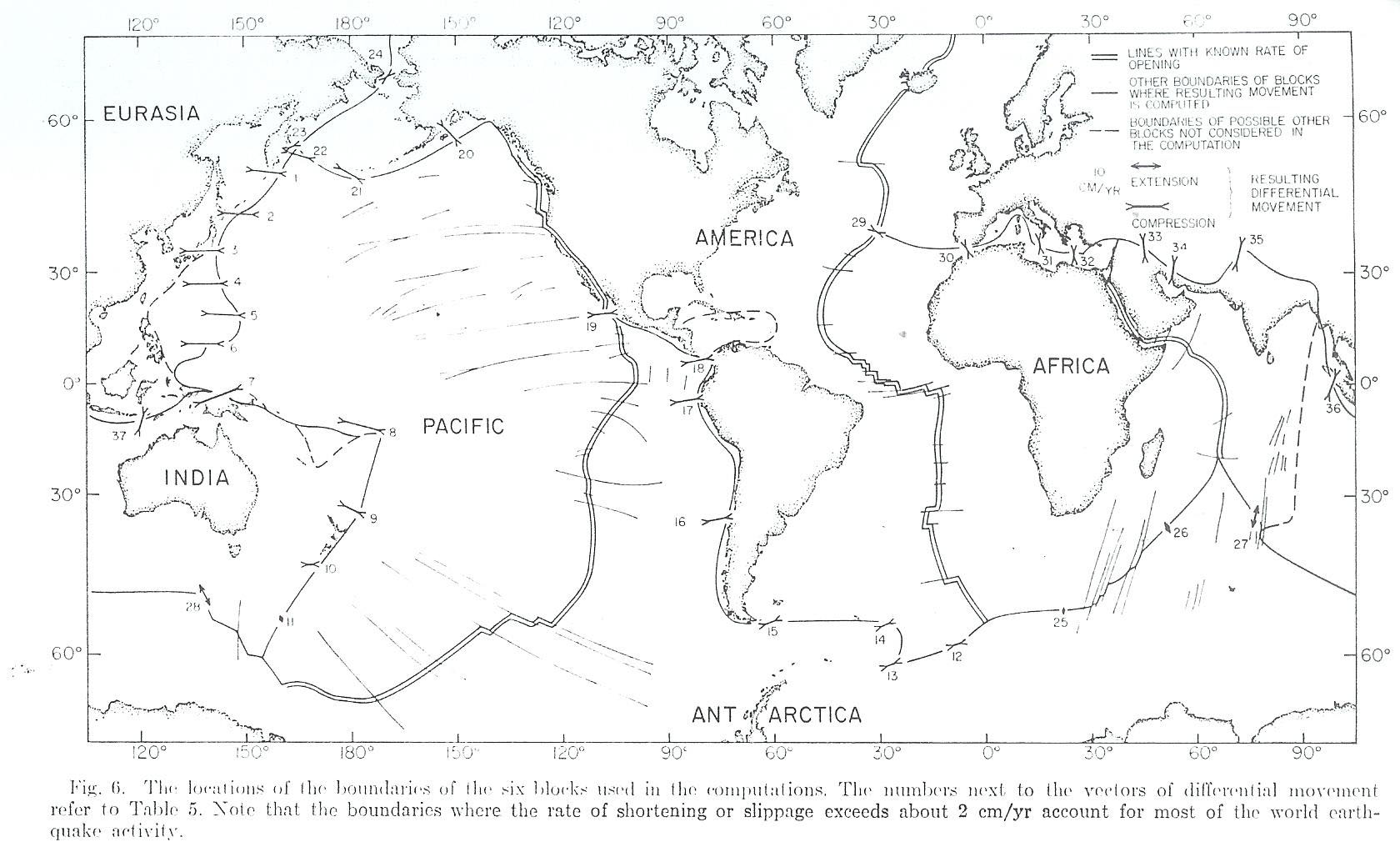
Figure 6 from Xavier le Pichon’s 1968 article presenting the six tectonic plates
PSL: The symposium on June 25-26 will bring together researchers from major international universities, most importantly the 3 authors of the foundational articles. What advice would you give to students hoping to take full advantage of the opportunity?
In my opinion, we are currently in a phase of rapid accumulation of data in this area, just as we were 50 years ago, that could lead two or three scientists to have the great idea that will revolutionize our understanding.
EC: For students with any level of interest in the Earth Sciences, there’s no question about it. The theory of plate tectonics is the theory of Earth Sciences--there is no other--and the symposium will bring together the experts in the field: you need to be there,
especially since the symposium will foster interesting discussions about the future of the theory. Although it is foundational, the theory of plate tectonics is not sufficient as it stands and will need to expand to include answers to questions about the life cycle of earthquakes, for example. In my opinion, we are currently in a phase of rapid accumulation of data in this area, just as we were 50 years ago for plate tectonics. Maybe two or three scientists will have the great idea that will revolutionize our understanding of earthquakes, and maybe 20 years from now we’ll arrive at a theory that doesn’t exist today!
PSL: Xavier le Pichon was director of the Geology Department at ENS, then a professor at Collège de France. What is his legacy? What is ENS’s current position in global research on plate tectonics?
EC: Xavier le Pichon did develop the ENS Geology laboratory and, in the 1980s-90s, made it a leader in the use of tectonic theory to explain geological processes. We have preserved that strong legacy. The laboratory is now made up of a group of scientists working on three complementary approaches to earthquakes: observation (seismology on the ground and spatial geodesics), experimentation (“test tube” earthquakes: reproducing the conditions for an earthquake in the lab), and modeling (producing mathematical equations that provide the theoretical framework for analysis). This puts us on the front lines globally in terms of understanding crustal deformations in general and earthquakes in particular.
PSL: How is research on plate tectonics evolving to reflect new computing capacity and other improvements in computer tools?
This year, we one of the world’s few scientists capable of modeling a realistic Earth. His work is a huge step forward that will give us a new understanding of the processes at work within our planet and allow us to piece together its history--and perhaps even anticipate its future!
EC: The most obvious change, here as everywhere, is in the mass of data now available. When I started, we had just a few sensors and had to report our data manually, observing curves with the naked eye. That is no longer possible! We have millions of sensors, with 20 years of continuous data. To extract the relevant information, we need to use new tools based on artificial intelligence or Machine Learning. This requires interdisciplinary projects, which is a good thing. We are also working more and more closely with mathematicians.
These new tools will enable us to digitally model an Earth in motion, including its tectonic plates. For a long time, this appeared to be an impossible challenge, in part due to our limited computing capacity. This year, we hired Nicolas Coltice, one of the world’s few scientists capable of modeling a realistic Earth, with its tectonic plates. His work is a huge step forward that will give us a new understanding of the processes at work within our planet and allow us to piece together its history--and perhaps even anticipate its future!
PSL: The University is placing a real emphasis on education through research. What would you like to say to students trying to choose a path?
EC: The geological sciences are the best field! They allow our students to explore their interests and skills in geology, physics, chemistry, and mathematics while working with an object that we hope is as permanent as they come: the Earth itself!
In addition, our students are trained to manage complexity. In geosciences, it is often pointless to isolate a process and study it alone, because geological systems are expressions of ongoing interactions between the solid Earth, the oceans, ice, and the atmosphere. It’s an exciting field with plenty of career options, both public and private.
PSL: You worked in Haiti to understand the aftereffects of the 2010 earthquake and help define a new risk prevention plan. How does your research fit in and interact with efforts to prevent and manage earthquake risks?
EC: As geoscientists, we are sometimes called upon to work on issues that directly affect society, such as after major events. This type of activity is not natural, since it forces us out of our “academic comfort zone.” Before serving as a scientific advisor for the United Nations in Haiti, I had only a very vague knowledge of the (abyssal!) gap between the advanced knowledge among scientists, on the one hand, and the ability to apply it in the field on the other. Yet the decisions that must be made are often very high stakes and potentially very costly, such as hundreds of millions of euros to rebuild hospitals, schools, and roads after the 2010 earthquake in Haiti. And while scientific knowledge is among the elements that should be considered when making a decision, it is unfortunately not always used effectively. As seismologists, it is therefore our responsibility to weigh in on these decisions, alongside financial backers and decision makers, contributing the scientific knowledge we have even when it is partial or sometimes uncertain. After all, climate scientists have long since organized and mobilized to serve as a useful source of ideas.
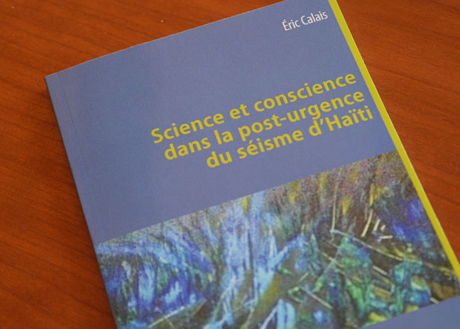
Eric Calais, Sciences et conscience dans la post-urgence du séisme d'Haïti, L'Harmattan, Paris, 2017
Photo credit: © Pôle communication de l'ENS